Geographic Information System
Tomasz Major, Pawel Roman, Remek Trzaska, Chris Walczak
Project Summary:
We develop a World Wide Web based
terrain visualization system in which high
quality 3D graphics, efficient compression techniques
and high-performance rendering are integrated.
Multiple GIS data, including satellite terrain images, weather information,
topographic maps or animated objects
can be layered to a digital elevation model to represent and visualize
a near-realistic 3D world. A framework is also implemented
to allow this system to run
in either single-user stand-alone mode or a collaborative mode
in which visualization of and navigation through a terrain by a master user
can be shared by other multiple users simultaneously.
Technology used:
- Terrain data and other GIS data are stored on a HTTP server
and are fetched over the network via HTTP protocol on the request of clients
- Ability to overlay multiple types of GIS data, including satellite
images, topographic maps, weather information, 2D (temperature)
and 3D (clouds) images
- Allow a user to navigate-through or fly-by the 3D GIS world by
changing camera positions, view points, zooming etc.
- Wavelet compression used for both Digital Elevation Model and
satellite images, reducing the size of data transmitted through the
network by a factor of 32 for DEMs and 30-60 for textures
- Adaptive mesh simplification technique is developed to reduce the number of triangles,
resulting in rendering time reduction by a factor of 40
- Delaunay triangulation to build the terrain surface
- SGI Open Inventor v. 2.1 for a visualization library
- Virtual world description is compatible with Open Inventor standard
- Collaboration mode runs in NPAC Tango system
Sample pictures
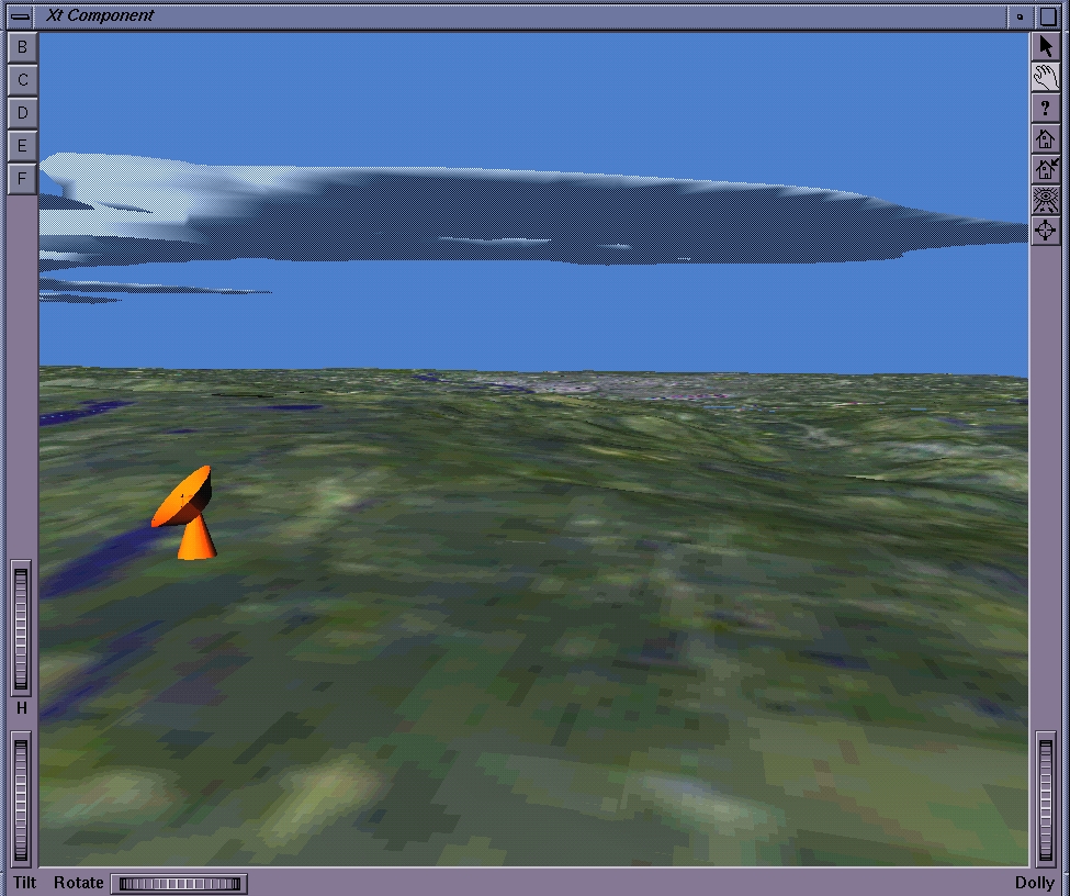
- Visualization and navigation in a 3D GIS model composed
of satellite terrain images and external
objects of a radar and clouds produced by a weather simulation code

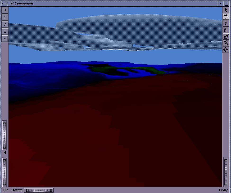
- Rain-fall and cloud information superposed
on an elevation model

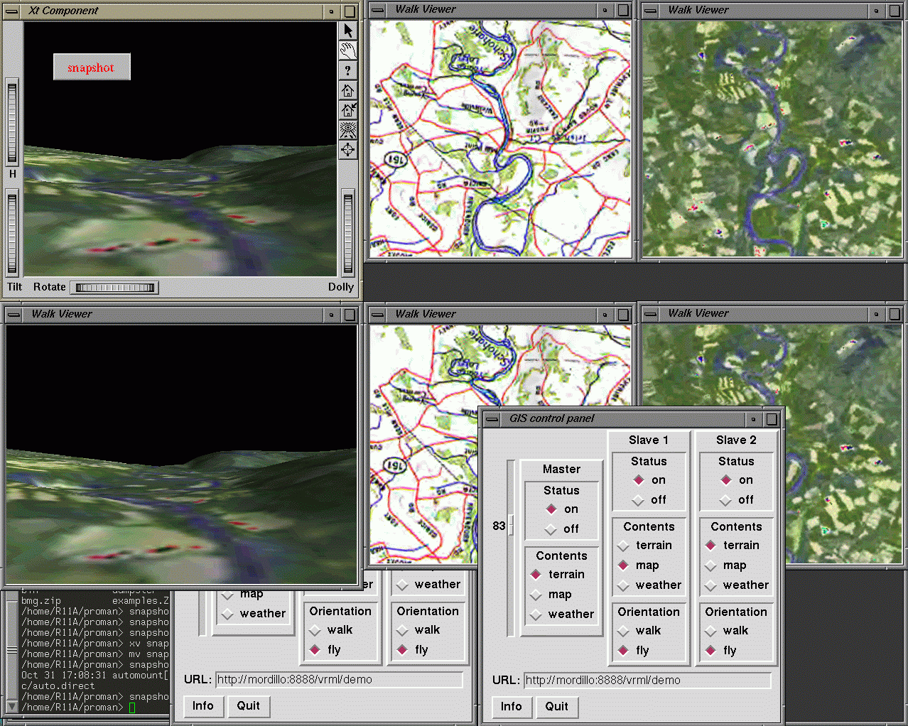
- Two GIS applications in master/slave mode. A slave
browser (lower one) is synchronized with the master one


