


Next: Satellite image data
Up: Sources of Terrain
Previous: Elevation data
\
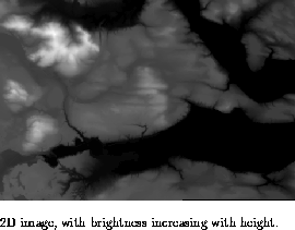
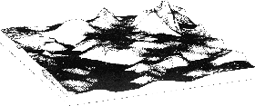 3D image with shadowing.
Digital Elevation Model (DEM) data for part of the Cascade mountains
in Washington state.
Paul Coddington, Northeast Parallel Architectures Center at Syracuse University, paulc@npac.syr.edu