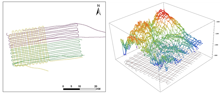
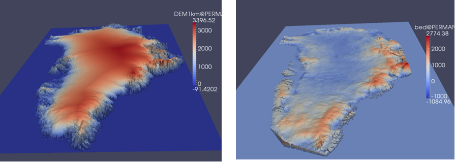
3D Visualization of Ice Sheets
Polar Grid has produced a significant amount of high-resolution geo-spatial data best analyzed with three-dimensional (3D) visualization techniques.
3D model of Greenland ice sheet:
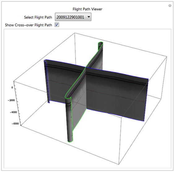
3D visualization of cross-over flight paths: